
Google Maps and Earth’s satellite imagery was last updated in 2013.
AB Wire
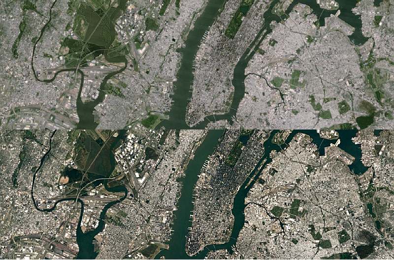
Search Giant Google announced that the company has updated its mapping applications with new, higher-resolution imagery from NASA’s Landsat 8 satellite. The update also includes photos from the United State Geological Survey and “new processing techniques for sharper images than ever before.”
Google Maps and Earth’s satellite imagery was last updated in 2013. At the time, Google used shot captured by the less-capable Landsat 7, which suffered a hardware failure back in 2003 that resulted in some portions of the world having diagonal gaps of missing data.
Google claims that it is mining data from nearly a petabyte of Landsat imagery. To put that in perspective, 700 trillion pixels is 7,000 times more pixels than the estimated number of stars in the Milky Way Galaxy. Or 70 times more pixels than the estimated number of galaxies in the Universe.
“To produce this new imagery, we used the same publicly available Earth Engine APIs that scientist use to do things like track global tree cover, loss, and gain; predict Malaria outbreaks; and map global surface water over a 30 year period,” wrote company in a blog post.