NASA’s Earth Science Technology Office funds the missions.
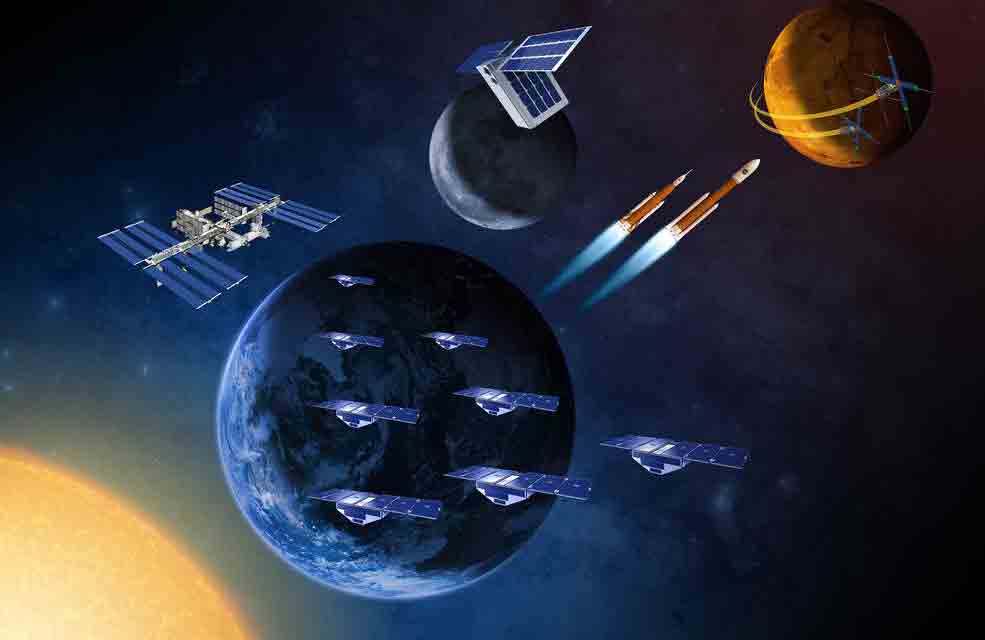 NASA is all set to launch a series of 6 satellites into the orbit aimed at measuring hurricanes, Earth energy budget, aerosols, and weather using a new method.
The satellites will be put into the orbit in separate missions that will commence from this month.
NASA has revealed that the size of these satellites varies from a loaf of bread to the size of a small washing machine. Overall, the weight of the payloads will differ from a few kilos to 181.4 kg.
The NASA statement also says the satellites will be put in the orbit as secondary payloads along with rockets sent on other missions. This is part of the agencies effort to cut the cost of the space missions.
The development of six tiny satellites was also managed cost effectively, thus providing more opportunities for scientists to test their latest technologies.
“NASA is increasingly using small satellites to tackle important science problems across our mission portfolio,” said Thomas Zurbuchen, associate administrator for NASA’s Science Mission Directorate in Washington. “They also give us the opportunity to test new technological innovations in space and broaden the involvement of students and researchers to get hands-on experience with space systems.”
NASA will launch the first satellite in this segment called RAVAN or Radio Assessment using Vertically Aligned Nanotubes. RAVAN is a CubeSat equipped with detectors that can find small changes in the energy budget of Earth’s top atmosphere, which is vital in understanding the greenhouse gas effects on climate.
The RAVAN project is headed by Bill Swartz from the Johns Hopkins Applied Physics Laboratory in Laurel, Maryland.
“NASA is expanding small satellite technologies and using low-cost, small satellites, miniaturized instruments, and robust constellations to advance Earth science and provide societal benefit through applications,” said Michael Freilich, director of NASA’s Earth Science Division in Washington.
The second mission is set to take off with two CubeSats to the International Space Station during the spring of 2017. These satellites will take a closer look at the clouds, giving scientists a better understanding of the role of clouds in climate change and weather.
The third satellite in the consolation is IceCube developed by Dong Wu of NASA’s Goddard Space Flight Center in Greenbelt, Maryland. It will use new, miniature, high-frequency microwave radiometer to measure cloud ice.
The fourth satellite in the series is HARP or Hyper-Angular Rainbow Polarimeter, developed by Vanderlei Martins at the University of Maryland-Baltimore County in Baltimore. This satellite is designed to measure airborne particles alongside with the distribution of cloud droplet sizes. The satellite uses a novel method that looks at a target from multiple perspectives.
The final satellite, MiRaTa or Microwave Radiometer Technology Acceleration mission is scheduled to launch in early 2017 along with National Oceanic and Atmospheric Administration’s Joint Polar Satellite System-1. MiRaTA’s miniature sensors will collect data on temperature, water vapor and cloud ice that can be used in weather forecasting and storm tracking.
The missions are part of the ambitious projects of NASA’s Earth Science Technology Office and is funded by the Earth Science Division of NASA.
“The affordability and rapid build times of these CubeSat projects allow for more risk to be taken, and the more risk we take now the more capable and reliable the instruments will be in the future,” said Pamela Millar, ESTO flight validation lead. “These small satellites are changing the way we think about making instruments and measurements. The cube has inspired us to think more outside the box.”
NASA also announced that its team working on Earth-observing technologies have successfully come out with two new satellite systems. One of these satellites called CYGNSS will fire up to space in December.
CYGNSS — the Cyclone, Global Navigation Satellite System — will be NASA’s first Earth science small satellite constellation. Eight identical satellites will fly in formation to measure wind intensity over the ocean, providing new insights into tropical cyclones. Its novel approach uses reflections from GPS signals off the ocean surface to monitor surface winds and air-sea interactions in rapidly evolving cyclones, hurricanes, and typhoons throughout the tropics. CYGNSS, led by Chris Ruf at the University of Michigan, Ann Arbor, is targeted to launch on Dec. 12 from Cape Canaveral Air Force Station in Florida. Derek Posselt of NASA’s Jet Propulsion Laboratory, Pasadena, California, is the deputy principal investigator.
TROPICS: Earlier this year NASA announced the start of a new mission to study the insides of hurricanes with a constellation of 12 CubeSats. TROPICS — the Time-Resolved Observations of Precipitation structure and storm Intensity with a Constellation of Smallsats — will use radiometer instruments based on the MiRaTA CubeSat that will make frequent measurements of temperature and water vapor profiles throughout the life cycle of individual storms. William Blackwell at the Massachusetts Institute of Technology Lincoln Laboratory in Lexington leads the mission.